This page is not an official page of the app or its developer, but an independent editorial publication created for informational and commentary purposes. Unless expressly stated otherwise, neither the app nor its developer is affiliated with, endorsed by, sponsored by, authorized by, or otherwise officially connected with MWM, Apple, Google Play, the app publisher, or the app's developer, and nothing on this page implies that the app was developed using MWM's services. Any trademarks, logos, screenshots, and other content remain the property of their respective owners.

Whympr | Ski, Hike, Climb
The ultimate all-in-one companion for technical athletes and safety-conscious explorers. Plan your next ski, hike, or climb with HD topographic maps, real-time avalanche bulletins, and professional topos curated by mountain experts.
Downloads
237K+User Rating
Total Ratings
2K+Publisher
Category
Health & FitnessLocales
4Latest Version
2.31.0Size
130.4 MBFirst Released
Sep 26, 2016Master Your Mountain Adventure
The all-in-one toolkit for technical mountain athletes. Access pro-grade 3D mapping, expert-led route guides, and real-time safety data to push your limits with confidence.
Advanced 3D Terrain Analysis
Visualize every ridge and gully in HD 3D. Use slope steepness overlays to identify risks and navigate complex alpine terrain like a professional.
Pro Topos & Expert Guides
Ditch the guesswork with professional-grade route descriptions and expert-verified topos used by world-class mountain guides.
The following screenshots and description are sourced directly from the app's official store listing and are the property of the app developer.
App Store
Screenshots
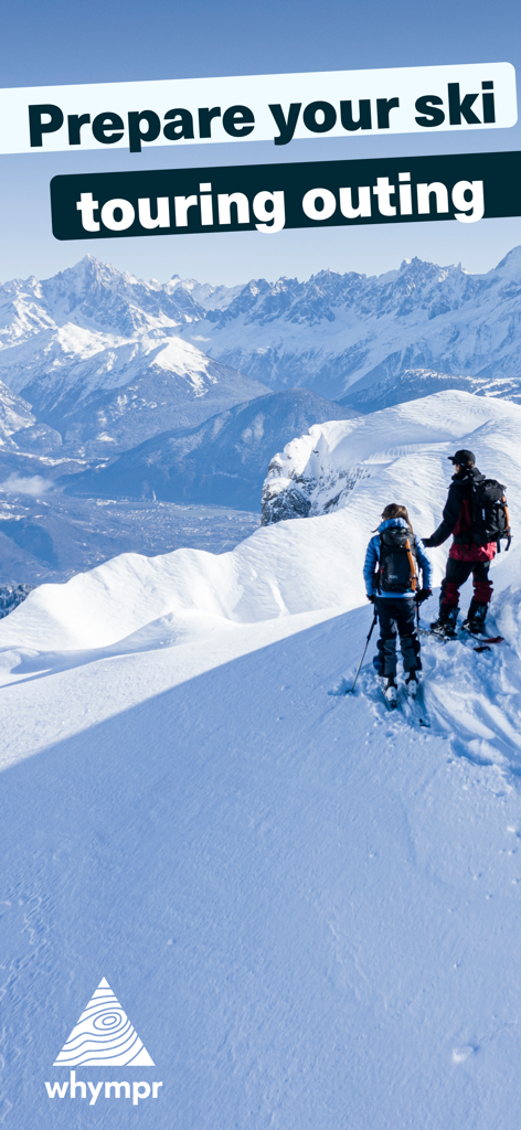
Two athletes ski touring on a snowy mountain ridge with a vast alpine landscape in the background
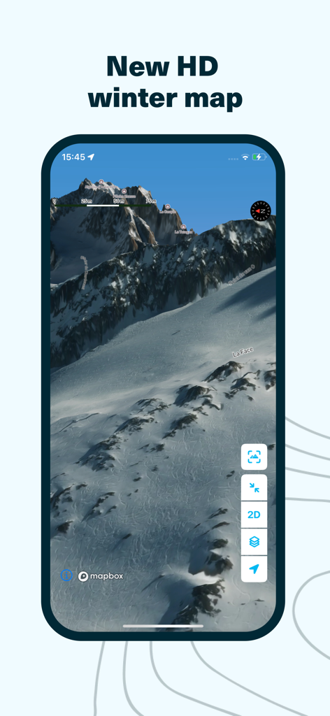
Whympr app screen displaying a 3D high-definition winter satellite map of snowy mountain terrain
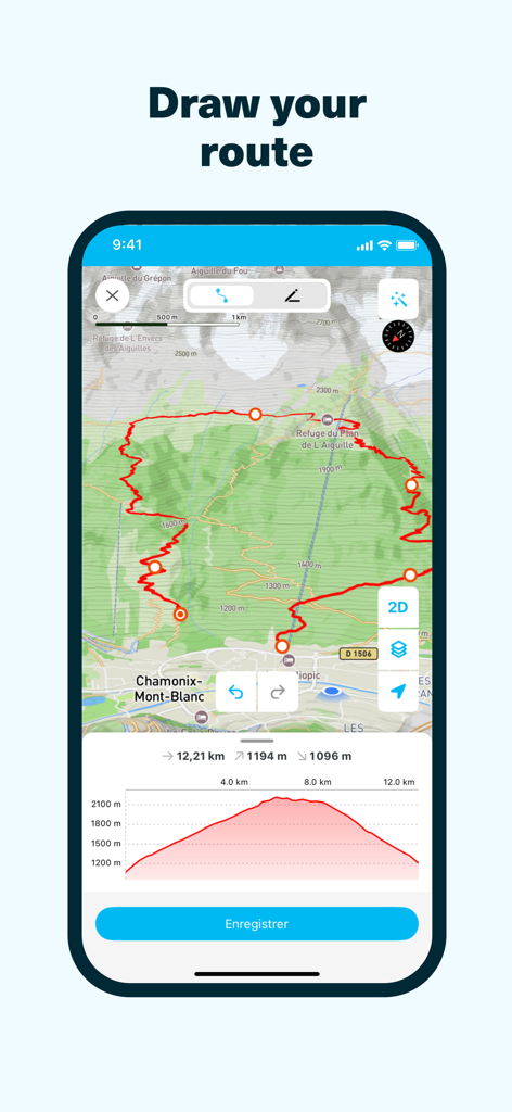
Whympr app interface showing a custom mountain route drawn on a map with a detailed elevation profile
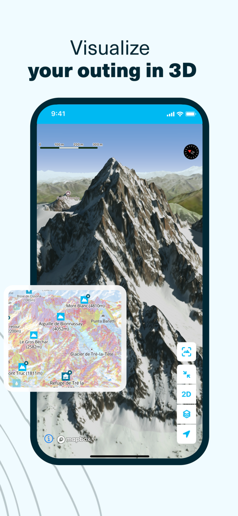
Whympr app interface displaying a 3D mountain landscape and topographic map for outdoor planning
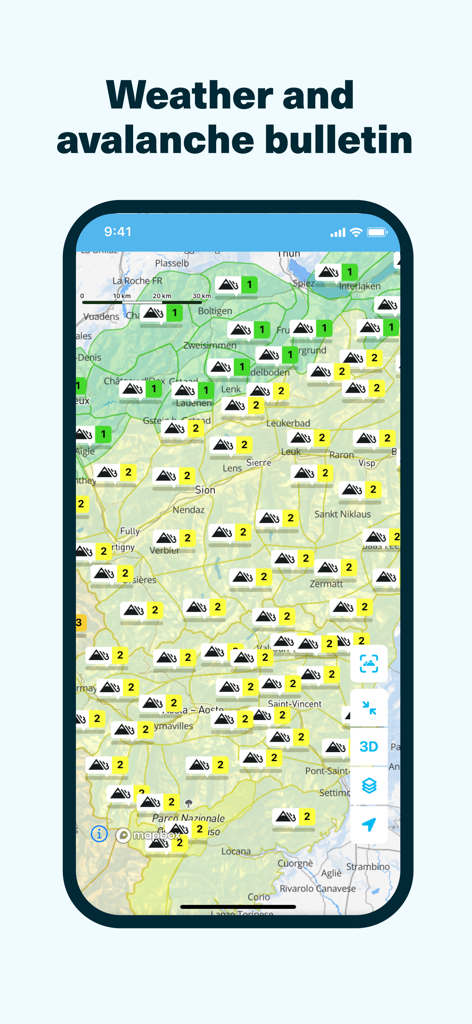
Whympr app interface showing a topographical map with mountain avalanche risk levels and weather bulletins
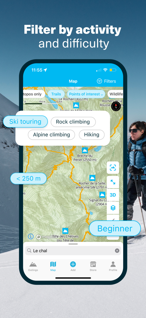
Whympr app interface showing filters for mountain activities and difficulty levels on a topographic map
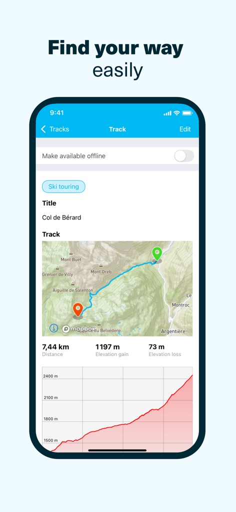
Whympr app displaying a ski touring track with map distance and elevation profile
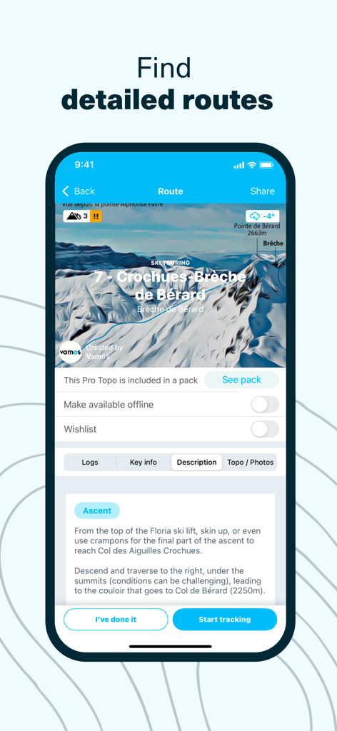
Detailed ski touring route with professional topo description and expert mountain data on the Whympr app
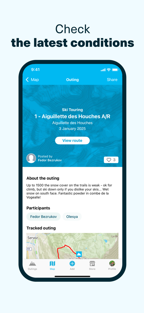
Whympr app interface displaying a community ski touring report with snow conditions and a GPS track
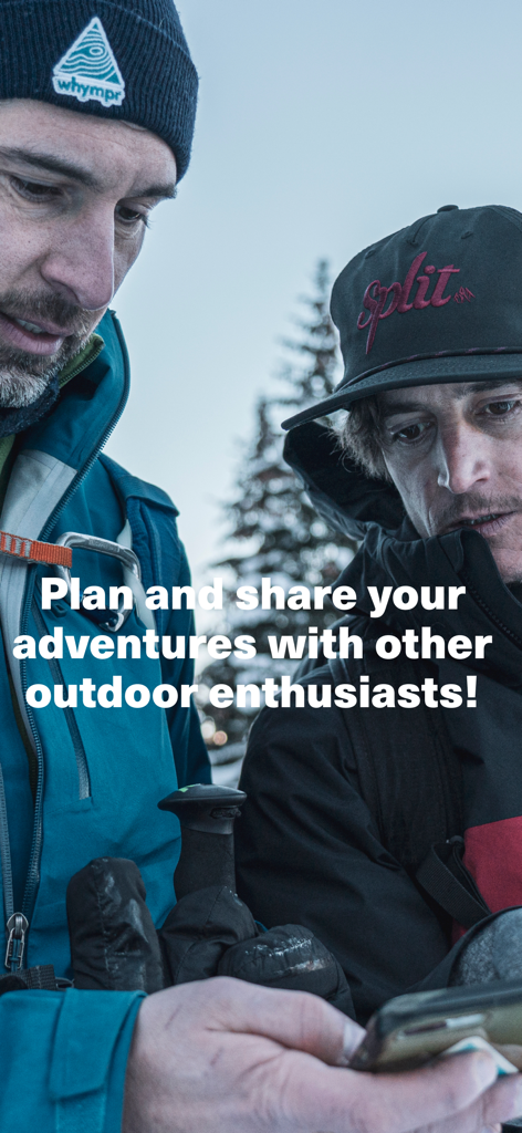
Two mountain athletes using the Whympr app to plan and share their outdoor adventures.
Description
Download
More Like This
Apps with similar features and user experience

AllTrails: Hike, Bike & Run
AllTrails, Inc.

Pedometer++
Cross Forward Consulting, LLC

Organic Maps: Offline Map
Organic Maps OU

Gaia GPS: Mobile Trail Maps
Trailbehind, INC.

Offline hiking maps: Mapy.com
Seznam.cz a.s.

Hiking Map Poland
Mapa Turystyczna sp. z o.o.

MapOut
Valnova GmbH

FarOut: Offline GPS Trail Maps
Atlas Guides DE, Inc.

Norgeskart
Norgeskart AS
This page is not an official page of the app or its developer, but an independent editorial publication created for informational and commentary purposes. Unless expressly stated otherwise, neither the app nor its developer is affiliated with, endorsed by, sponsored by, authorized by, or otherwise officially connected with MWM, Apple, Google Play, the app publisher, or the app's developer, and nothing on this page implies that the app was developed using MWM's services. Any trademarks, logos, screenshots, and other content remain the property of their respective owners.