This page is not an official page of the app or its developer, but an independent editorial publication created for informational and commentary purposes. Unless expressly stated otherwise, neither the app nor its developer is affiliated with, endorsed by, sponsored by, authorized by, or otherwise officially connected with MWM, Apple, Google Play, the app publisher, or the app's developer, and nothing on this page implies that the app was developed using MWM's services. Any trademarks, logos, screenshots, and other content remain the property of their respective owners.

ヤマレコ 山登りがもっと楽しくなる登山アプリ
Master the terrain with heatmapped trail data, voice-guided off-route alerts, and seamless Apple Watch integration. Navigate deeper, hike safer, and stay connected where cell service ends.
Downloads
494K+User Rating
Total Ratings
17K+Publisher
Category
SportsLocales
1Latest Version
8.27Size
131.1 MBFirst Released
Jun 10, 2016Master the Backcountry
Professional-grade tools for navigation and safety, built for those who treat the mountains with respect.
Verified Offline Maps
Navigate without cell service using high-resolution topo maps and community heatmaps that show you exactly where the path really is.
Off-Route Voice Alerts
Stay focused on the terrain with hands-free audio notifications that alert you instantly if you deviate from your planned route.
The following screenshots and description are sourced directly from the app's official store listing and are the property of the app developer.
App Store
Screenshots
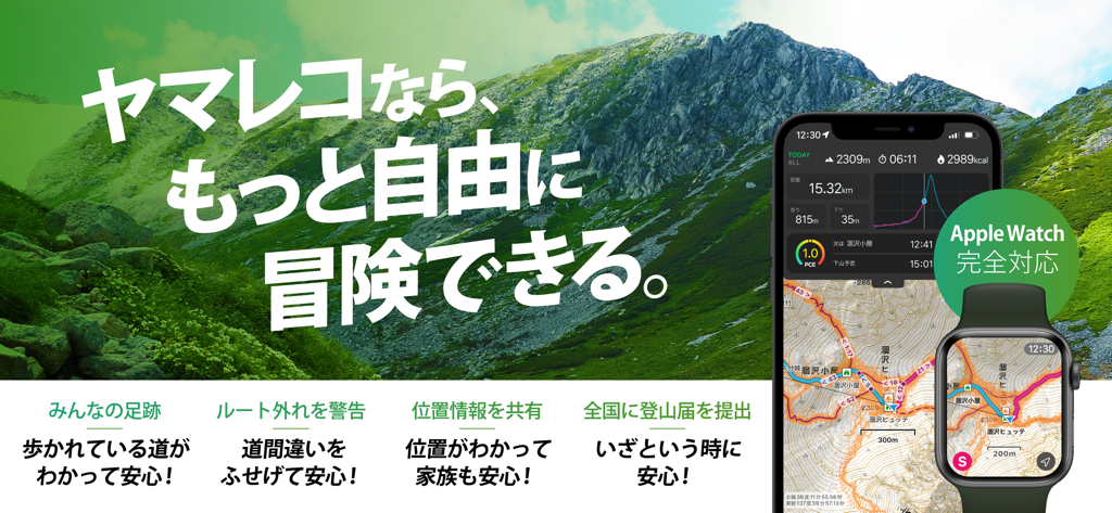
Yamareco hiking app interface on a smartphone and Apple Watch showing topographic maps and outdoor navigation data in a mountain setting.
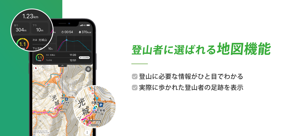
Yamareco app interface showing a topographic mountain map with hiker heatmaps and elevation stats.

Yamareco app showing topographic maps and hiking data on Apple Watch.
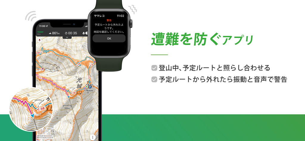
Smartphone and Apple Watch displaying a topographic hiking map and an off-route safety warning notification
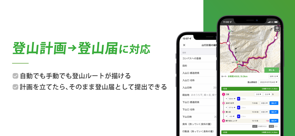
Yamareco app interface showing a mountain climbing route map and a plan submission form

Yamareco app interface showing mountain hiking photos and community trip reports
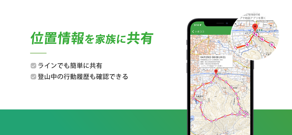
Smartphone displaying the Yamareco app live location sharing feature with a hiking route on a topographical map.
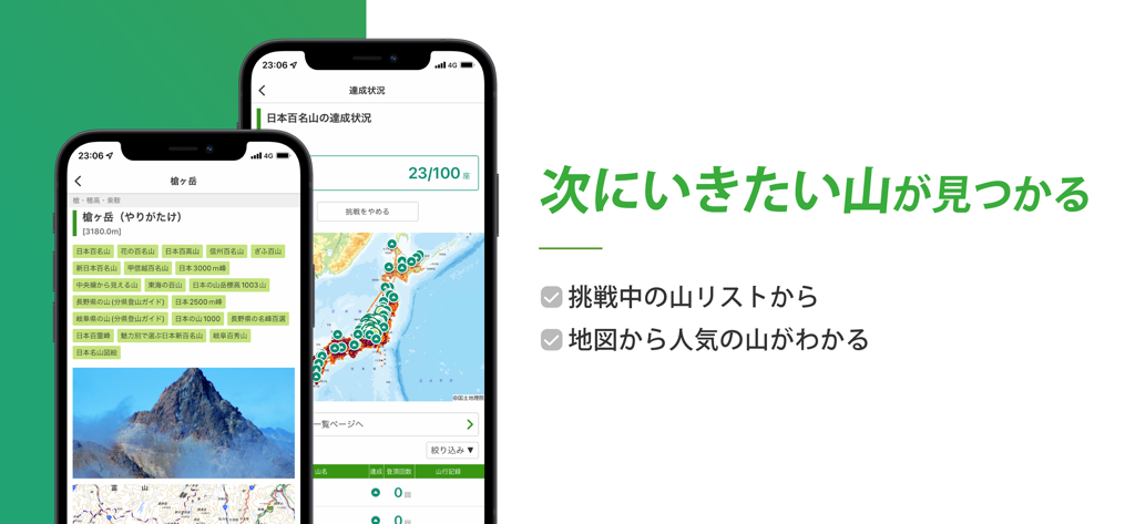
Yamareco app interface displaying mountain lists and a progress map for hikers
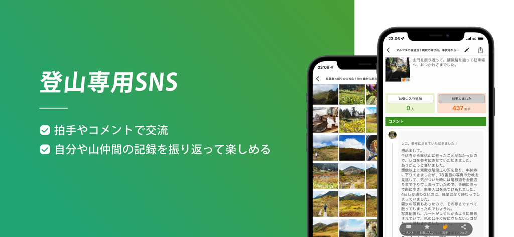
A mobile interface for Yamareco hiking app showing community photo logs and social networking features for backcountry hikers
Description
Download
More Like This
Apps with similar features and user experience

AllTrails: Hike, Bike & Run
AllTrails, Inc.

Pedometer++
Cross Forward Consulting, LLC

Organic Maps: Offline Map
Organic Maps OU

Gaia GPS: Mobile Trail Maps
Trailbehind, INC.

Offline hiking maps: Mapy.com
Seznam.cz a.s.

Hiking Map Poland
Mapa Turystyczna sp. z o.o.

MapOut
Valnova GmbH

FarOut: Offline GPS Trail Maps
Atlas Guides DE, Inc.

Norgeskart
Norgeskart AS
This page is not an official page of the app or its developer, but an independent editorial publication created for informational and commentary purposes. Unless expressly stated otherwise, neither the app nor its developer is affiliated with, endorsed by, sponsored by, authorized by, or otherwise officially connected with MWM, Apple, Google Play, the app publisher, or the app's developer, and nothing on this page implies that the app was developed using MWM's services. Any trademarks, logos, screenshots, and other content remain the property of their respective owners.