This page is not an official page of the app or its developer, but an independent editorial publication created for informational and commentary purposes. Unless expressly stated otherwise, neither the app nor its developer is affiliated with, endorsed by, sponsored by, authorized by, or otherwise officially connected with MWM, Apple, Google Play, the app publisher, or the app's developer, and nothing on this page implies that the app was developed using MWM's services. Any trademarks, logos, screenshots, and other content remain the property of their respective owners.

WingX®
Elevate your situational awareness with award-winning Synthetic Vision, real-time ADS-B weather, and advanced flight planning. The trusted choice for General Aviation, offering premium performance and exclusive free subscriptions for VFR and Military pilots.
Downloads
116K+User Rating
Total Ratings
1K+Publisher
Category
NavigationLocales
1Latest Version
9.2.6.206Size
80.4 MBFirst Released
Jun 30, 2010Precision Navigation for the Professional Pilot
Experience a feature-rich Electronic Flight Bag designed to enhance safety and efficiency, from pre-flight planning to final approach.
Next-Gen Situational Awareness
Fly with confidence using Synthetic Vision, GPWS terrain alerts, and real-time ADS-B traffic and weather overlays on a high-performance moving map.
Military & VFR Focused Value
Access industry-leading aviation tools with dedicated free subscription tiers for active or retired military personnel and VFR-only pilots.
The following screenshots and description are sourced directly from the app's official store listing and are the property of the app developer.
App Store
Screenshots
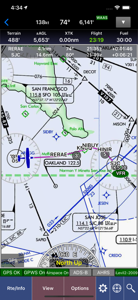
WingX aviation navigation map showing flight data and sectional charts over the San Francisco area.
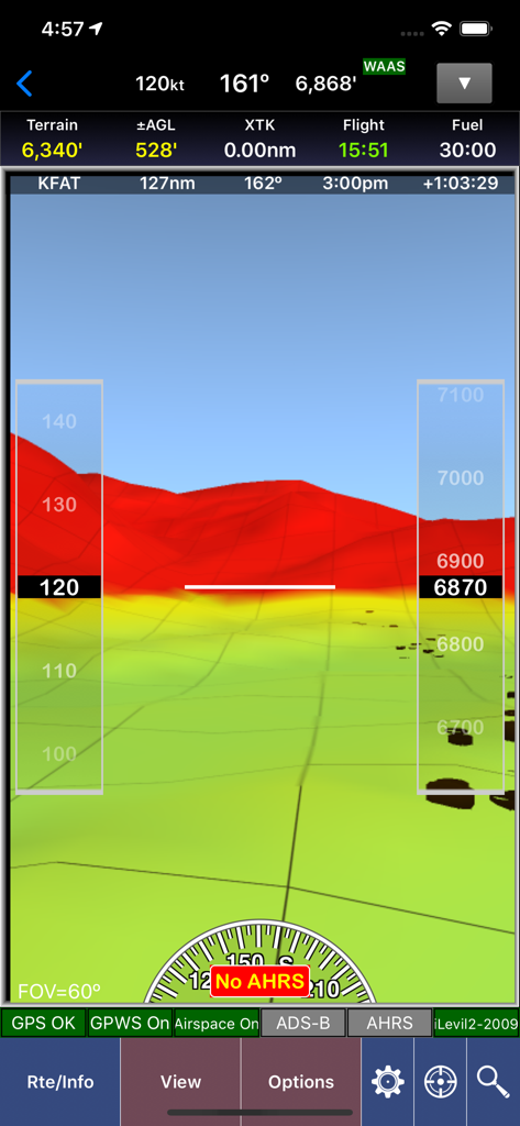
WingX app screenshot showing synthetic vision with 3D terrain mapping and flight instrument overlays
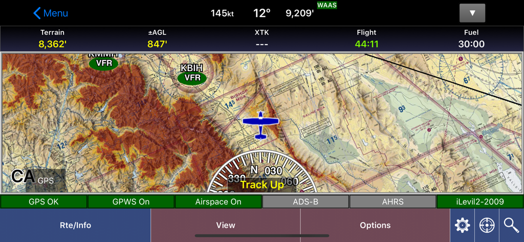
WingX aviation app moving map interface showing terrain details and flight data
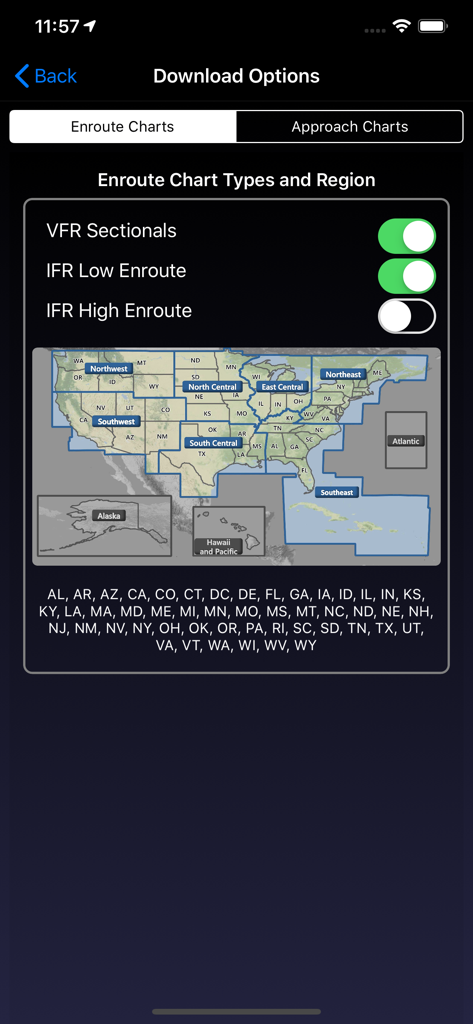
WingX app Download Options screen for selecting enroute charts and US regions
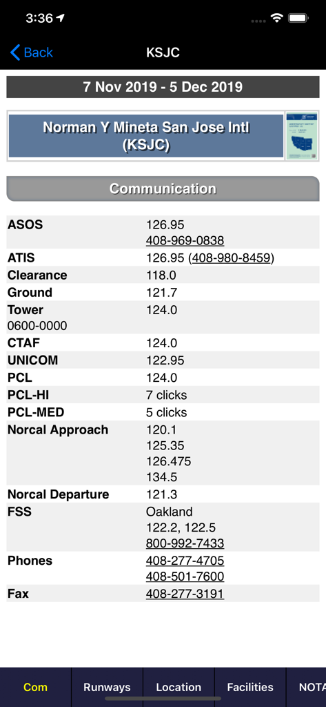
Aviation communication frequencies for San Jose International Airport on WingX app
Description
Download
More Like This
Apps with similar features and user experience

Navigraph Charts
Navigraph KB

SkyDemon
Divelements Limited

Airports
Applicate Ltd

OzRunways EFB
OzRunways Pty. Ltd.

fDeck: flight instruments
Darren Yeates

Noisy Goose
Automata Solutions Ltd.

StationWeather - METAR and TAF
Oliver Puetz

Drone UAV Fly Forecast: AirMap
MONIQ TAP COMPANY LIMITED

Airmate
Myriel Aviation SA
This page is not an official page of the app or its developer, but an independent editorial publication created for informational and commentary purposes. Unless expressly stated otherwise, neither the app nor its developer is affiliated with, endorsed by, sponsored by, authorized by, or otherwise officially connected with MWM, Apple, Google Play, the app publisher, or the app's developer, and nothing on this page implies that the app was developed using MWM's services. Any trademarks, logos, screenshots, and other content remain the property of their respective owners.